AB Storm

MurrayManeraHeads Up Edmonton
#abstorm
#edmonton #yeg #yegdt https://t.co/j8GmK0qUodTue, 28 Jul 2026 05:25:28 GMT
shakypubcoNow that’s one helluva #thunderstorm! ☔️ #ABwx #ABstormTue, 28 Jul 2026 04:48:21 GMT
shakypubcoMonster 👹 Supercell! 💯 #ABstorm #ABwx 🌪️Tue, 28 Jul 2026 04:42:58 GMT
kimmydee_26Well this seems prophetic considering the forecast for tomorrow. #yegwx #abstorm https://t.co/jjcheGbnHLTue, 28 Jul 2026 04:21:22 GMT
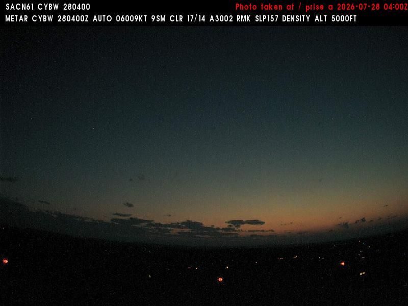
neufmille_hal1https://t.co/Mv57wcTqf9
#cybw #abstorm https://t.co/UtOSOpajIoTue, 28 Jul 2026 04:10:57 GMT
HunterMarkewichLatest video posted breaking down the high risk setup for tomorrow!
#abstorm
https://t.co/KdOs5fY0etTue, 28 Jul 2026 03:37:20 GMT
ScanetJanetMother Nature is pure. Simply. #abstorm #AlbertaTue, 28 Jul 2026 03:35:18 GMT
StayHumblenKindOn our way to @CanadianTire to buy a canoe or something, based on tomorrow's forecast〰️good chance we'll need one 🤷♀️ #abstorm ⛈Tue, 28 Jul 2026 02:46:57 GMT
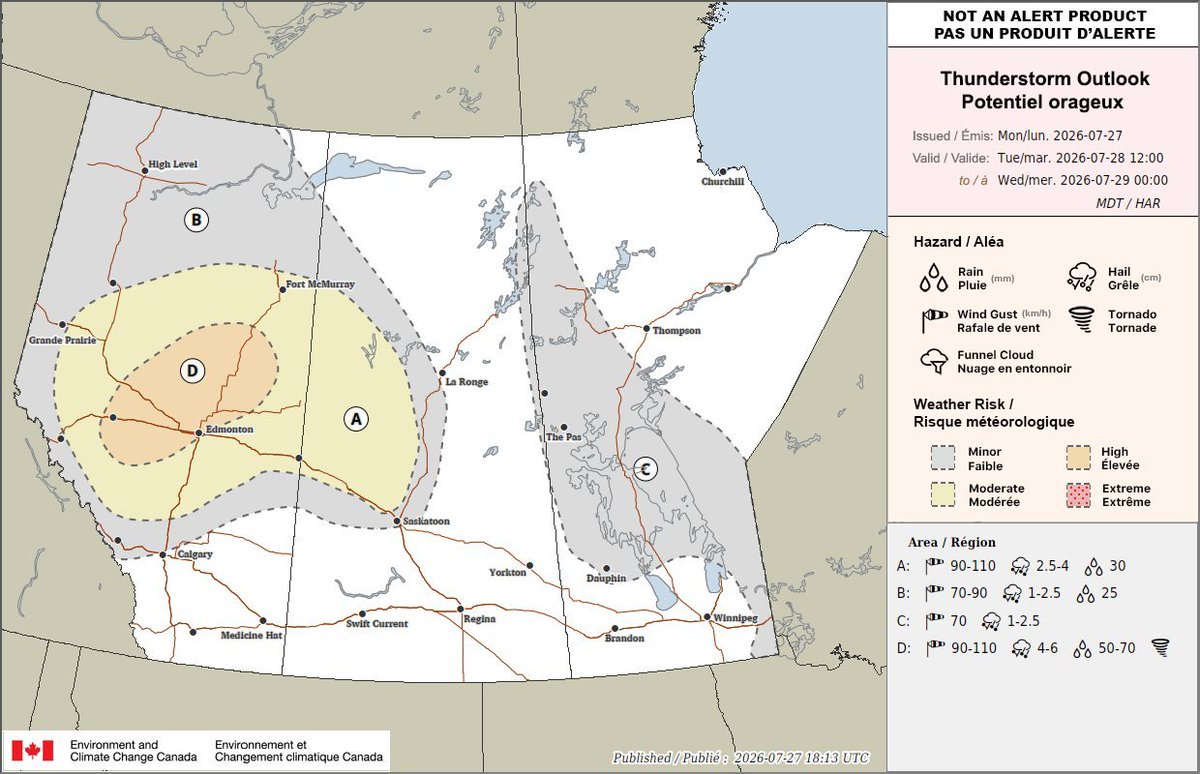
RFD_MaverickTomorrow is another active day. Stay up-to-date.
#abstorm https://t.co/9Jyy8oId3NTue, 28 Jul 2026 01:52:50 GMT
MorganLaidlerFun fact:
June is currently still (officially) rainier than July has been for Edmonton.
269.0mm compared to 263.5mm
Top five rainiest days (so far)
5) June 27 - 36.2mm
4) June 1 - 41.0mm
3) July 15 - 41.2mm
2) July 11 - 49.4mm
1) June 21 - 64.0mm
#yegwx #abstormTue, 28 Jul 2026 01:11:56 GMT
511AlbertaUpdate: ECCC severe thunderstorm warning ended for forecasted areas. For details, visit: https://t.co/kmbRcnv95A (6:36pm) #ABRoads #ABStormTue, 28 Jul 2026 00:36:12 GMT

MorganLaidlerA lot of severe thunderstorm watches have been lifted including the Edmonton and Red Deer areas as well as the foothills.
Also, the chance for a thunderstorm for Edmonton tonight is basically gone.
All tornado watches have ended too.
#yegwx #abstorm https://t.co/osp5TP1miTTue, 28 Jul 2026 00:17:29 GMT
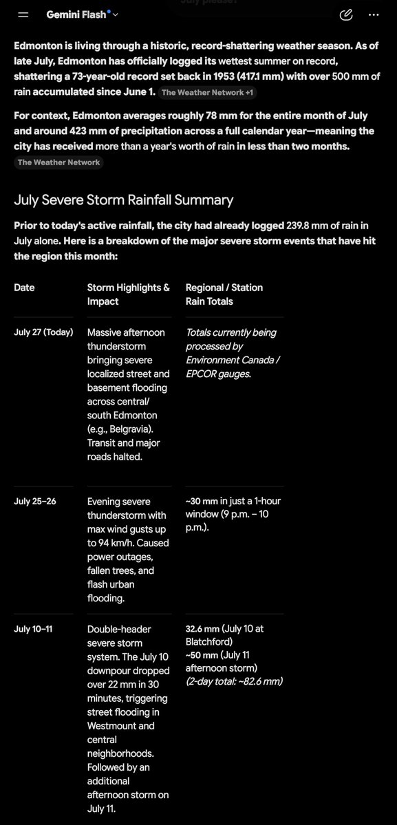
mikeawesome00Over 500mm since June 1! 👀
#yegwx #abstorm https://t.co/AXWbUI7E8hMon, 27 Jul 2026 23:52:37 GMT

FlatlanderHank#Mammatus on SE flank of Chauvin #abstorm https://t.co/YaCyUvDBE0Mon, 27 Jul 2026 23:37:36 GMT
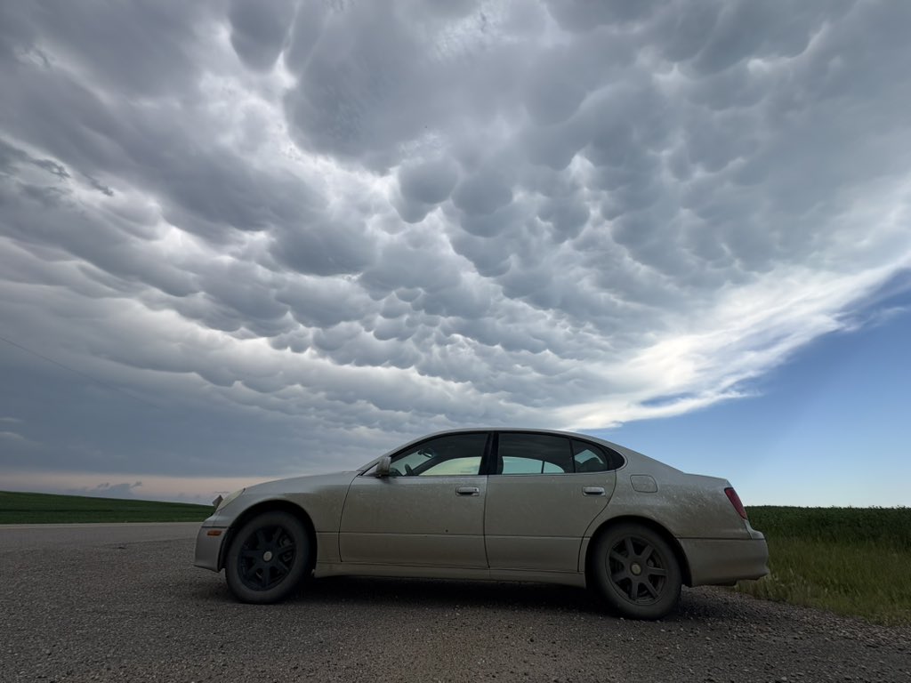
BenCherneskyBig time mammatus cloud intercept to end the chase near Chauvin, AB
#abstorm @teamdomcanada https://t.co/YBlG0qEY1yMon, 27 Jul 2026 23:28:44 GMT
DogsRHeavenEdmonton storm drain flooding. 😯
#yeg #yegwx #abstormMon, 27 Jul 2026 23:14:49 GMT
GlobalEdmontonAnother day, another storm. Three waves of heavy rainfall doused the Edmonton region Monday afternoon as a line of storm cells swept northeast across central Alberta.
#yeg #abstorm #yegwx #yegtraffic
https://t.co/PR4WeImARUMon, 27 Jul 2026 23:12:57 GMT
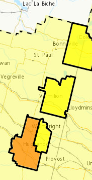
511AlbertaECCC severe thunderstorm warning in effect for forecasted areas. For details, visit: https://t.co/kmbRcnv95A (4:59pm) #ABRoads #ABStorm https://t.co/cIDVqnTCyrMon, 27 Jul 2026 23:00:04 GMT
CalgaryRASCAnyone know of a localized #abstorm event in SE Calgary (~Ricardo Ranch) at 2:30 AM Saturday morning? My son had a swirling mist laden wind lift patio cushions off his back deck, lofted them over his two-story home and dropped in the middle of the front street. Dead calm after.Mon, 27 Jul 2026 22:47:45 GMT
JessicaNgCBCI now get why the pooling water is being called a second river, causing a road closure by the James MacDonald Bridge 👀... #yeg #abstorm
https://t.co/JFEJVFFXD7Mon, 27 Jul 2026 22:44:44 GMT

Slummer90Strong model agreement for a significant severe weather setup across the area Tuesday evening around central Alberta.
Multiple models are showing high-end parameters for rotating storms, w/ potential for large hail, damaging winds, and isolated tornadoes . #yeg #yegwx #ABstorm https://t.co/2QNCEorUl4Mon, 27 Jul 2026 22:33:34 GMT
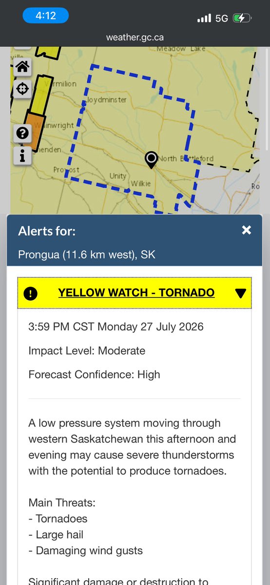
kokochaseswxTornado watches have now been extended into western Saskatchewan for this evening. I’ll be out chasing and providing live updates whenever I can! #skstorm #abstorm https://t.co/Oul03ZcH5fMon, 27 Jul 2026 22:13:50 GMT
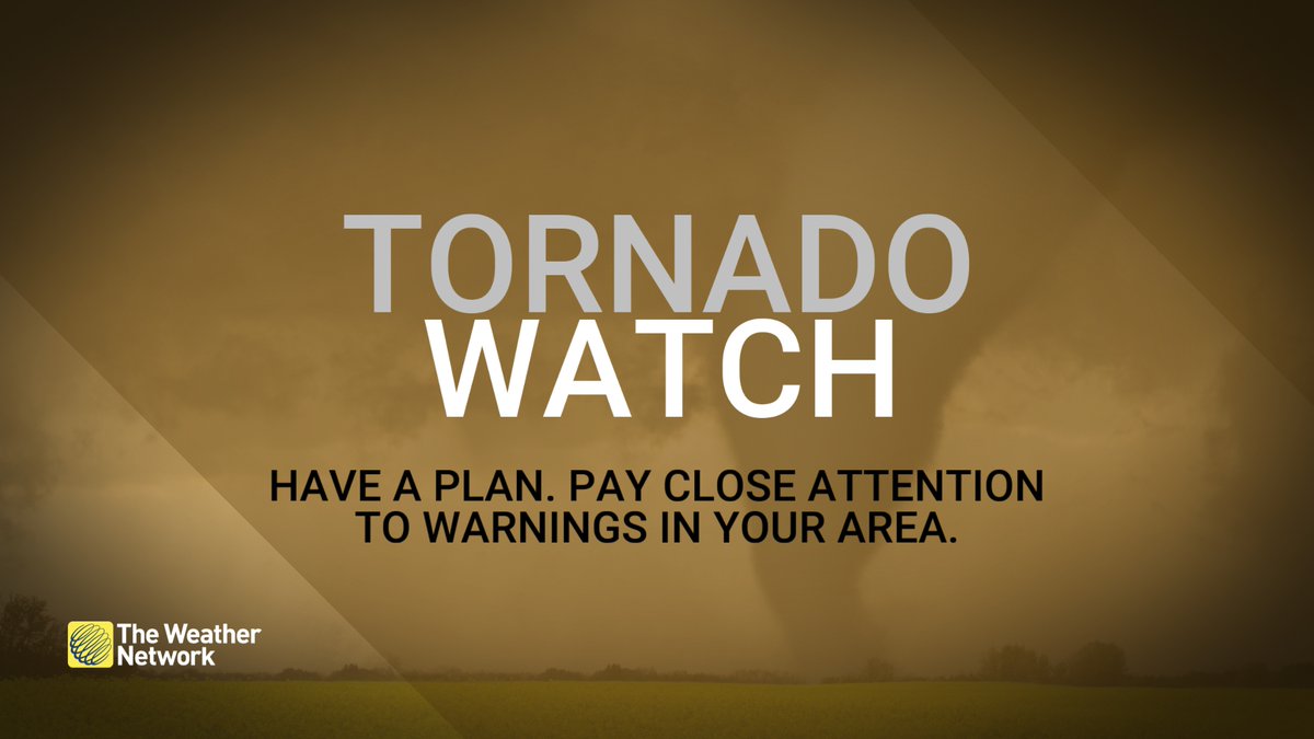
weathernetworkA tornado WATCH is in effect for parts of Alberta and Saskatchewan. Stay alert and have a plan in place. Conditions are favourable for the development of tornadoes. #ABstorm #SKstorm https://t.co/c8ObiskWI0Mon, 27 Jul 2026 22:12:35 GMT
BadWeatherKyleThe Edmonton storm train keeps on chugging.
Today's storm brings the July total at Blatchford up to 260.7 mm.
Another storm is possible tomorrow evening.
If more than 22 mm falls by Friday night, July 2026 will become the wettest month ever. #yegwx #abstormMon, 27 Jul 2026 22:04:12 GMT
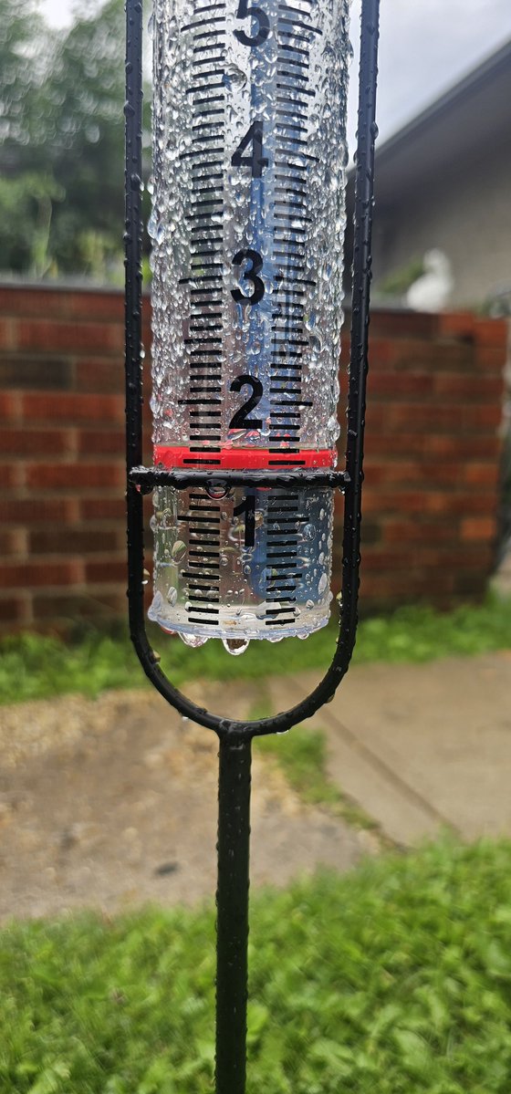
SHomeniuk76870Todays rainfall ammounts so far with the thunderstorms that went through the east side of edmonton earlier #abstorm #yegwx https://t.co/LQ039hfjWnMon, 27 Jul 2026 21:59:06 GMT